- Home
- Newsroom
Newsroom
The Latest News from Dabeeo
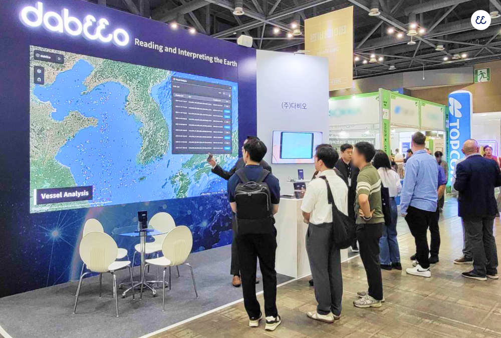
[Expo] Participated in Korea’s Largest Geospatial Expo, 2025 K-GEO Festa
2025-09-30 조회수 2630The 🌏2025 K-GEO Festa, hosted by the Ministry of Land, Infrastructure and Transport and organized by LX Korea Land and Geospatial Informatix Corporation, was held over 3 days from September 24 to 26.
Under the theme “GEO AI. Driving Change, Shaping the World” the event welcomed around 15,000 participants, including more than 130 companies and institutions from over 30 countries. In particular, its joint hosting with the 2025 World City-Tech Expo not only expanded the scale of the exhibition but also marked a milestone in extending the application of geospatial technologies to the smart city domain.
Dabeeo also took part in the 2025 K-GEO Festa, highlighting the possibilities and future of the geospatial industry.
AI and Digital Twins are at the core of next-generation land management technologies.
Leveraging advanced AI-based geospatial analysis and high-precision capabilities, Dabeeo has been expanding its business portfolio and establishing itself as a leading company in the geospatial industry. Reflecting this growing presence, our booth drew strong interest from industry professionals and visitors worldwide, creating meaningful opportunities for new connections and possibilities.

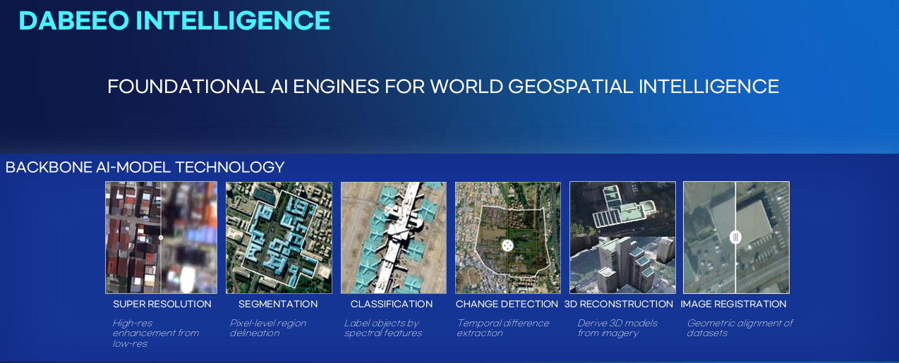
Dabeeo’s AI-powered analysis technology begins with a Super Resolution transformation of multi-source imagery, including satellites.
This technology can enhance 30cm-grade ultra-high-resolution satellite imagery up to 4 times, enabling more accurate data analysis through the acquisition of high-quality source data.
In addition, Dabeeo possesses a wide range of core AI technologies such as Object Detection and Classification, road and building-level Segmentation, time-series Change Detection, and 3D modeling for digital twin implementation. Combined with Image Alignment technology, these capabilities enable precise comparative analysis under identical conditions, delivering highly reliable outputs.
Building on these technological strengths, Dabeeo has achieved tangible business results. In July, we secured a nationwide project to detect and analyze changes in the use of state-owned properties across South Korea. We are also carrying out ship detection and classification projects to enhance maritime security, as well as long-term monitoring of palm oil plantations in Southeast Asia through advanced agri-specialized analysis technologies.
Beyond digital geospatial data construction, Dabeeo delivers insights through precise analysis and interpretation of spatial data, supporting optimal decision-making across diverse sectors such as urban administration, agriculture, defense, and environment.
Dabeeo continues to create new value with AI and spatial data. Stay tuned for the next chapter of our journey.✨
📰 See related articles
🔗 Dabeeo Selected by KAMCO for Nationwide AI-Based Change Detection Project
-
[Expo] Dabeeo Showcased AI Defense Solutions at AUSA 2025
-
[Expo] Participation in Satellite Application Conference 2025
Join Dabeeo on the path to becoming a global leader.